

Salish Sea Islands - Canada Side 1
Onto the Canadian side of the big Island Adventure! You can read parts 1 and 2 here that cover the USA:
https://www.thepoxbox.com/posts/salishusa1
https://www.thepoxbox.com/posts/salishusa2
We’re starting on the U.S.A. side, which has much nicer paved Islands than Canada’s crappier infrastructure and gravel roads I got a whole new bike for.

Salt Spring Island
Ferry Access
Fun Fact: “The island was the first of the Gulf Islands to be settled by non-First Nations people.”
By far the most visited of all the islands ranking top5 in total size when it comes to road networks but way up there in terms of attractions and amenities. It also offers 2 ferry terminals from which you can do interesting big loops to Crofton ( 60km from Victoria ) or Vancouver. The roads are bumpy and punchy and Mt. Tuam is a solid and steep climb and the highest paved one you can do without driving all the way up island to Mt. Washington. There’s also a gravel road that goes all the way up to the island’s highest peak, Mt.Bruce, at about 705m. I’ve not been there yet! While pretty high of a point it still gets beat out by 30m by Mt.Constitution on Orcas Island.


People are a bit intimidated to bike on here because it’s nothing but sharp up and down pitches and narrow roads in forested residential areas. It’s a slog if you don’t have the gearing.
There’s not a whole lot else to do here but there is a small town in the center with some shops and cafes. This is big for an island to have because you often have to sit and wait for a ferry for up to 2 hours. Might as well eat a nanaimo bar.
Pender Island
Ferry Access
Fun Fact: “Pender Island is also home to Canada's first olive grove, called Waterlea Farm.[14] 100 trees were originally planted by owner Andrew Butt with the goal of producing the first "Made in Canada" olive oil.[15]”


Saturna Island
Ferry Access
Fun Fact: “Mount Warburton Pike viewpoint, which is the tallest mountain in the Outer Gulf Islands.[13] On its peak, there is a communication tower used by a variety of radio and television services.[14]”
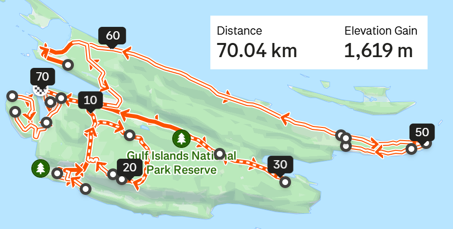


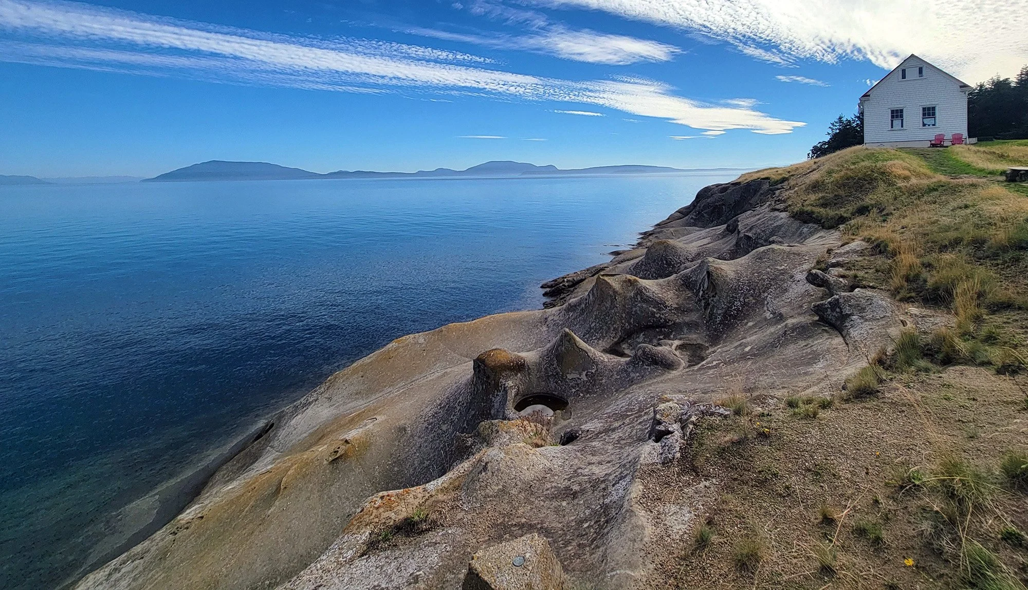
The other interesting feature are these rock formations at the East Point of the island, which is also a prime location for whale-watching! This island really has it all, unfortunately you do need a gravel bike to get up/down the mountain unless you’re feeling extra adventurous. Definitely the most underrated island and it makes my top5 overall with the main downsides being that there’s not much for bike stops other than the Winery and the ferry service means you have to commit a full day to just this.
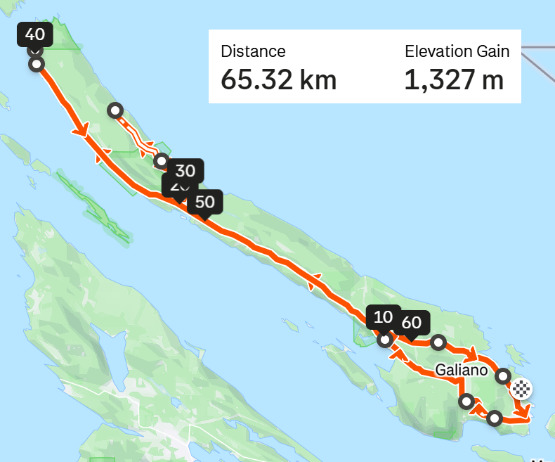
Galiano Island
Ferry Access
Fun Fact: ”In a major flight path for migrating birds, Galiano has hundreds of bird species,[18] such as bald eagles, herons and cormorants.”
I knew I was in trouble when the ferry worker said “Oh no I’ve never been to Galiano”. It’s the most difficult to access of the Gulf Islands because it has sparse ferry service and the longest trip.
There’s really not a whole lot to do there, just a long out-and-back road and lots of punchy hills. Most of the view is obstructed by forests and cottages, as is tradition.
Avoid, mainly because this will be your full day…


Not the largest island but you can make it a decent day if you loop around different roads. This island has lots to see and do for being so small since it was historically a hub for travel and commerce between Vancouver and the Gulf Islands.
Drop by the Japanese Memorial Garden in memory of the displaced Japanese people who were relocated elsewhere in Canada during WW2. Don’t hear about THAT stolen land very much…
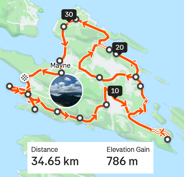
Mayne Island
Ferry Access
Fun Fact: ”Miners Bay is also the site of the Springwater Lodge which was built in 1892 and remains the oldest continuously operated hotel in British Columbia.[2]”


Thetis Island
Ferry Access
Fun Fact: ”Thetis Island also operates one of the few one-room schoolhouses left in Canada.”
How very retro!
Thetis is located higher up island off the town of Chemainus. One ferry services both this island and the nearby Penelakut Island which you aren’t supposed to get onto unless you are part of the tribe who owns/runs it.
There’s a mix of gravel/paved roads here and some pretty steep climbing. I had a mechanical so I didn’t get to visit most of the island so maybe I’ll go back some day. You definitely can make a nice trip out of it if you loop around roads or do out-and-backs and there’s some shops and cafes to refuel at.


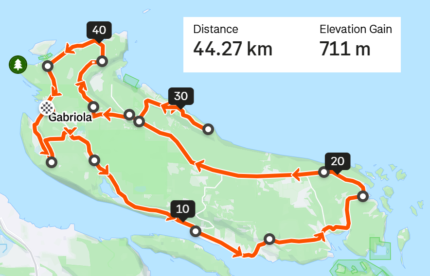
Gabriola Island
Ferry Access
Fun Fact: ”It is known as the Isle of the Arts due to its high percentage of working artists, and its many cultural events include annual festivals related to art, poetry, gardens, music, boating and fishing.”
Located right off Nanaimo, it’s easy to access by a 20 minute ferry that runs all day long. You can stretch it to an 80km day if you do all the roads and there’s lots to see and do if you want to take your time. Good island!


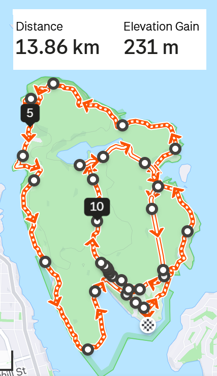

Newcastle Island
Ferry Access
Fun Fact: ”The original U.S. Mint building in San Francisco was to have 8 columns from the Newcastle Island quarry but 2 sank in a shipwreck off Mayne Island.”
The ferry leaves every hour from the north side of Nanaimo. The whole island is mostly covered in forest and while there’s a few gravel trails suitable for cycling it’s mainly a hike with lots of big roots and rocks. Would not bike here.
It’s nice for a pleasant day trip or an overnight camp if you lived near Nanaimo. Not exactly worth a detour otherwise.


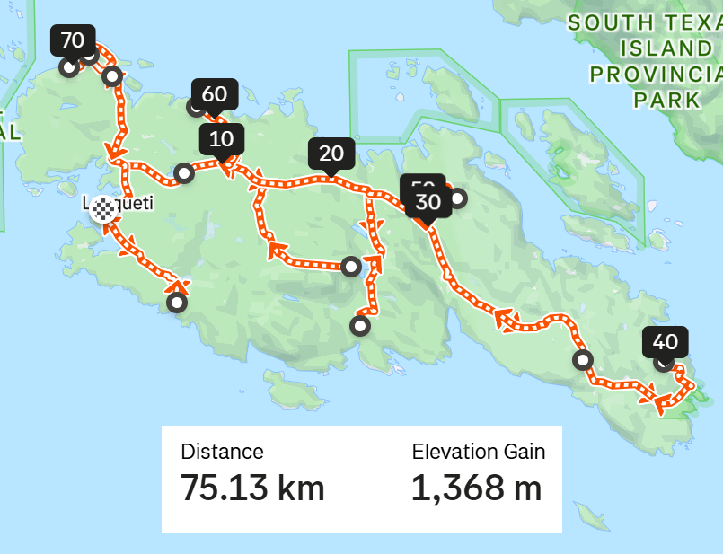
Lasqueti Island
Ferry Access
The island community is an enclave of Canadian counter-culture. Lasqueti Island is one of the least developed of the major Gulf Islands. Its roads are mostly unpaved, and it is the only one of the larger Gulf Islands that is not currently connected to BC Hydro's electrical power grid.”
There’s a ferry twice a day leaving from French Creek, 2 hours from Victoria so you’ll be stuck here the entire day with only one ferry option back. All the roads are gravel or rough pavement and it’s pretty punchy, as always. Not much to do or see as forests obscure most of the view.
I’m not entirely sure this island is worth the entire day commitment but I had a good time.


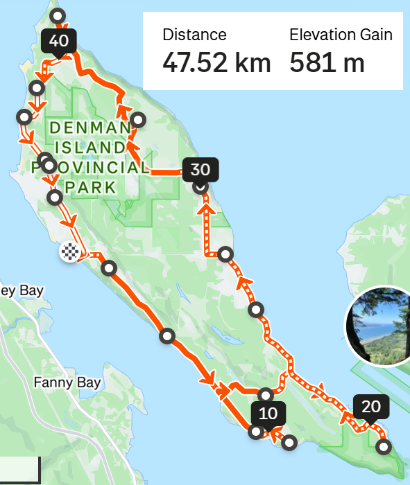
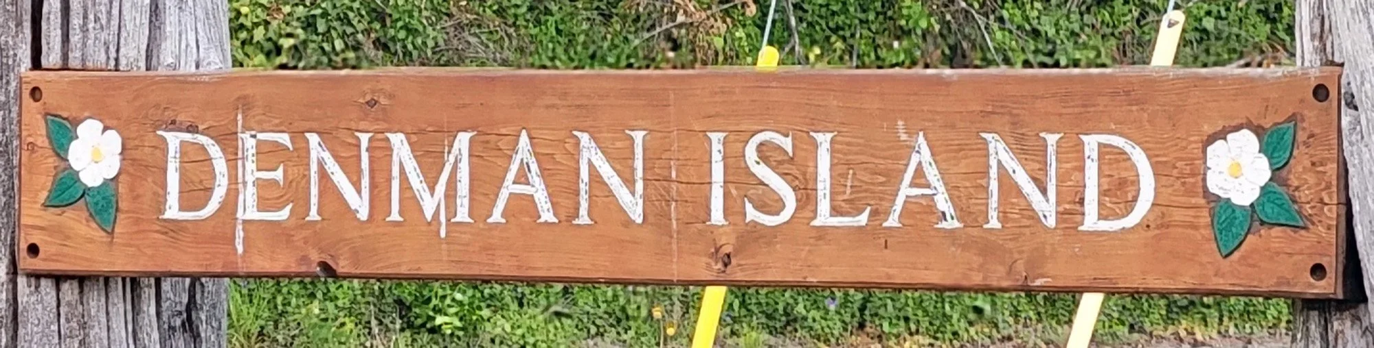
Denman Island
Ferry Access
Fun Fact: ”A number of potters, weavers and painters have made Denman Island their home for decades.[10]”
I didn’t visit much since I blasted through to make the Hornby Island connector ferry. You have to go through Denman to get to Hornby so doing both in a day requires sacrifices. They’re linked via a cable ferry which is an interesting system that drags the boat along a huge steel cable instead of using a conventional motor.
This island has a good mix of sandy gravel roads and paved with a little town where you can relax and recharge. Being 200km away from Victoria it starts to stretch what is reasonable to do for a day trip.


Hornby Island
Ferry Access
Fun Fact: ”The Late Cretaceous Northumberland Formation is exposed in the northern and western part of the island. Fossil collectors have found ammonite and baculite fossils at Boulder Point on Hornby Island.[4]”
So lucky! Strava was very confused by this island. It showed mostly gravel but half of it is paved, a good section is just a hiking trailing to loop back to the ferry from the south and the middle is just a huge network of challenging mountain bike trails absolutely not suited for gravel bikes…. as I quickly found out.
There seems to be a thriving wine community here as well. Definitely a place you can spend a day, however it’s hard to access as it requires taking a ferry to Denman and then crossing that island to take another ferry into Hornby.

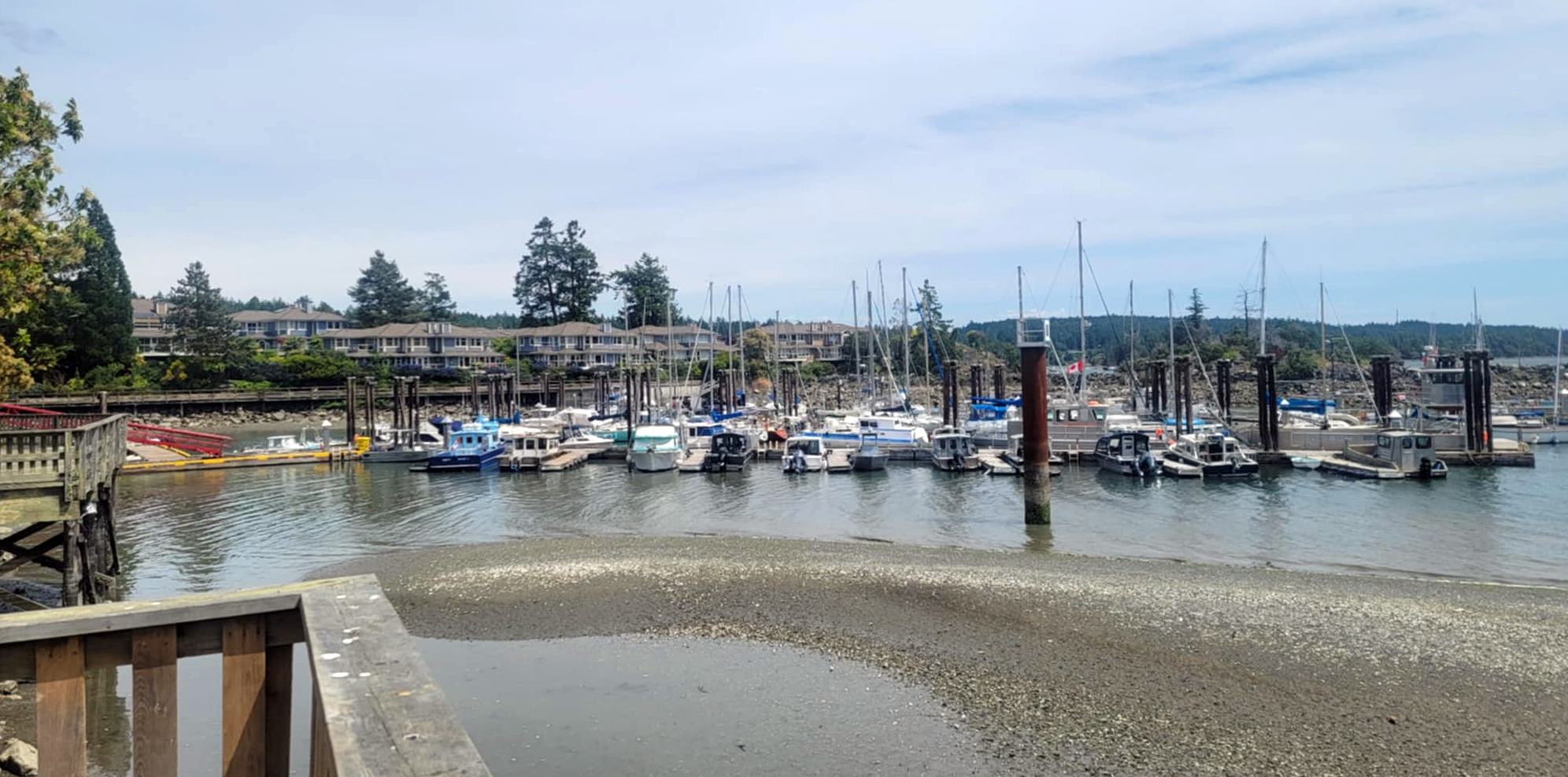
Full view of Denman Island from the Hornby terminal


Last one for part 1!
That does it for all the easier to access islands that everyone is more familiar with. Next up we’re starting to reach far up island and onto the sunshine coast where you need several days to commit to visit from Victoria.