

Salish Sea - U.S.A. Islands 1
Biking in the same place all the time can get boring. Why not visit every Island with bikeable roads you can access via public means?
After a few years of only ever going to Salt Spring that’s what I decided to do!
You will need a gravel bike to do many of the Canadian ones but all the U.S. ones are nicely paved.
The loop starts by taking a ferry from Victoria down to Port Angeles, driving all around the coast up to Seattle then north across the border to Vancouver where you can take a ferry to the Sunshine Coast. You then drive west before crossing back on Vancouver Island at Powell River. Then you can drive west 3 hours to Port McNeil to access the two most remote Islands with basically nothing on them!
It was a fun trip that gave me a lot of downtime to visit museums and enjoy camping.

I broke this down into multiple parts because there’s over 50 islands and 30 museums / attractions.
Starting on the lower USA side ending in Seattle with Mercer Island.


Bridge Access
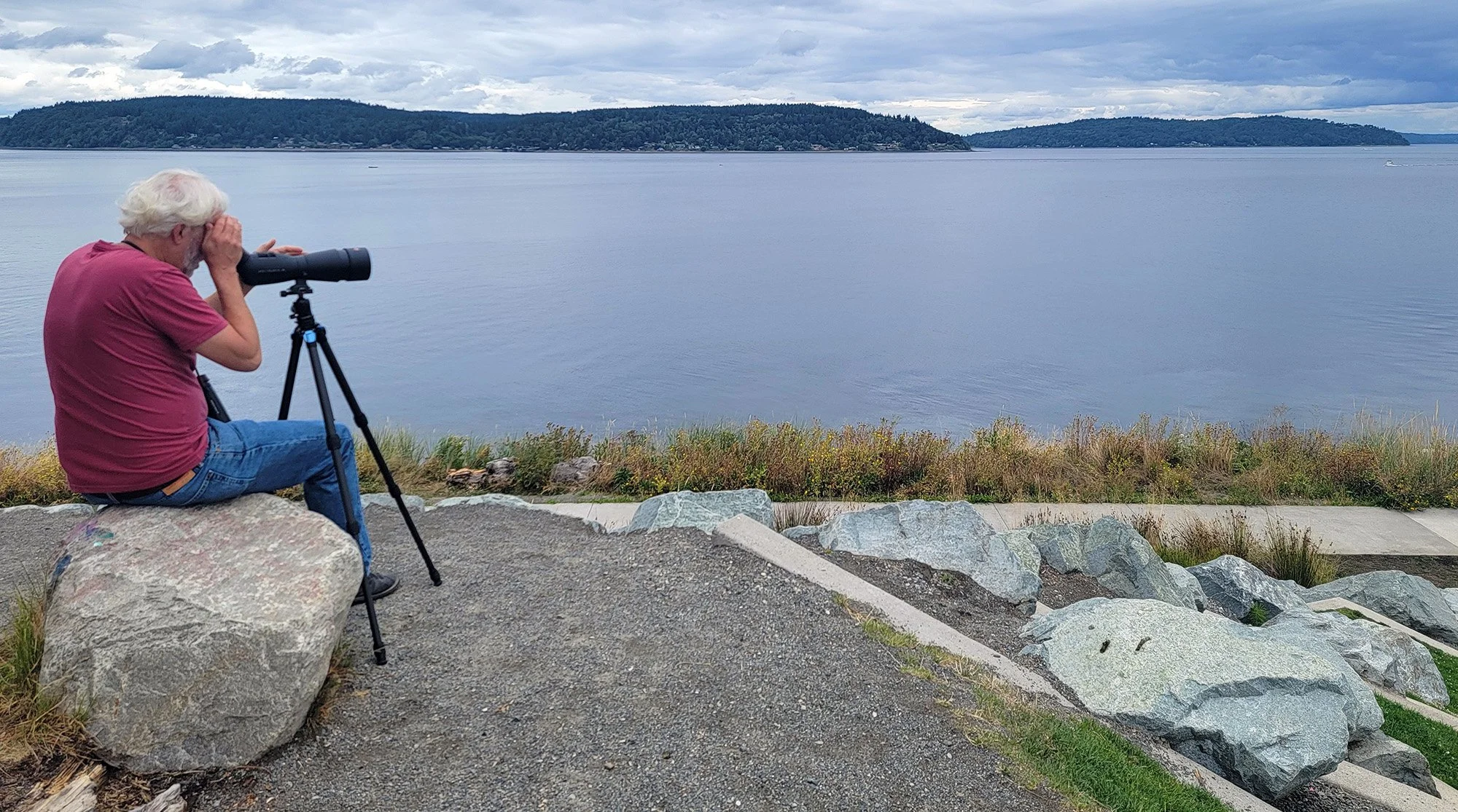
Indian Island is used as a munition depot for the navy and as such is mostly off limits to civilians. Strava doesn’t know that of course so it will let you plot a route all around it! Hurray! It’s good to not trust Strava when going to more remote/random areas because it has no idea what is and isn’t private, dangerous, closed or a military base.

Marrowstone Island fun fact: “It was given the name "Marrow-Stone Point" in 1792 by the British explorer, George Vancouver, in describing the area's hard, clay-like soil.[3]”
I guess when you make maps of all new places you really have to sit down and spend 10 hours of your day naming every boulder, cliff, inlet and hill that you come across so you can help other people navigate. Most of the Islands on the US side were discovered ( aka patented lol ) in this 1792 expedition.


Reach + Stretch Island
Bridge Access
Nothing to see on either of these, mostly just rich people’s cottage with water access.


Not much going on this sleepy little island, mostly residential with some small hobby farms.
Harstine Island
Bridge Access
Fun fact: “Before a bridge was constructed, the island was served by the Harstine Island ferry. The cost in 1962 was 50¢ (fifty cents) for car and passengers.”


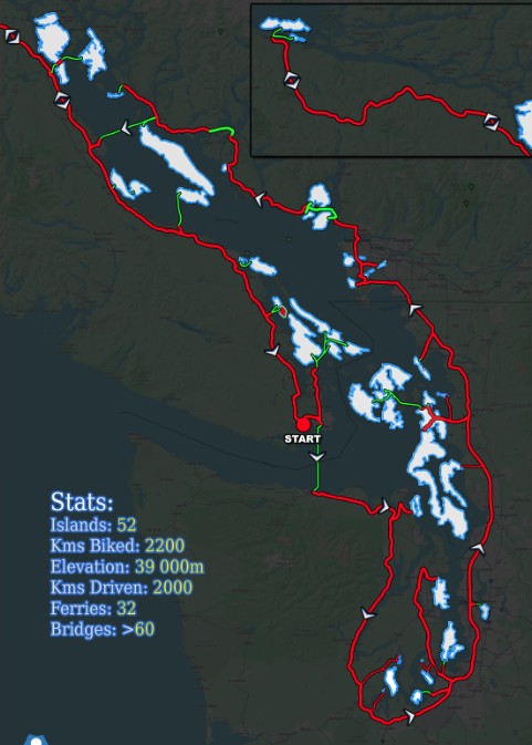
This Island wins the coveted “Smallest Island of the entire Trip” grand prize with under a mile of road.
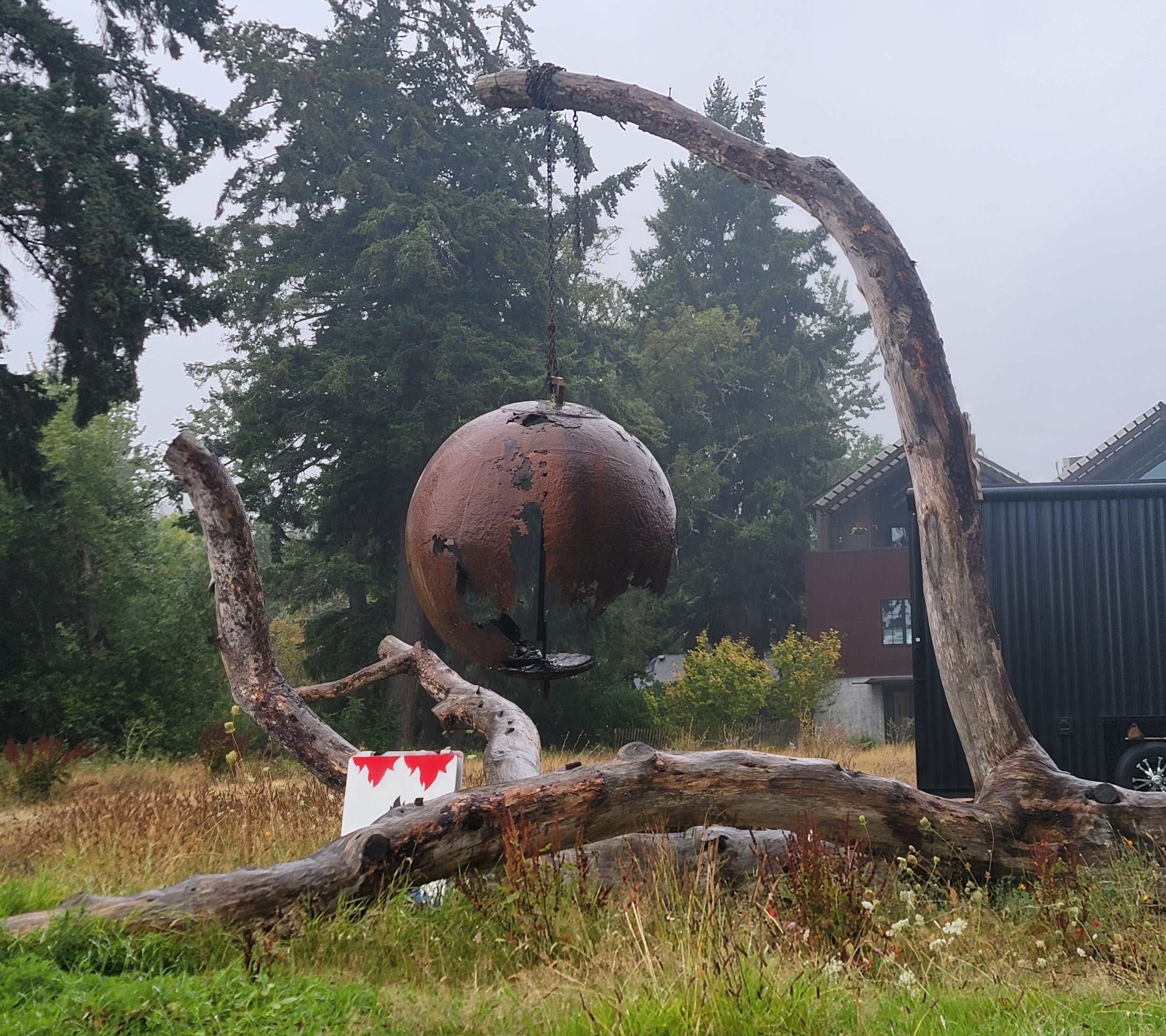
right: Near Shelton, some guy built a Paul Bunyon display out of one of those old Muffler Men you can find all across America.
Steamboat Island
Bridge Access
Population: 41


Right: McNeil Island off in the distance. Only way to get there is to be sent to Federal prison.
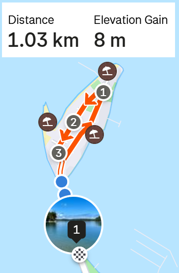
Anderson Island
Approx Loop Size: 45km Ferry Only
Fun Fact: The only General Store on the island is run by a local resident of the island.
That’s the FUNNEST fact. It seems to be a sleepy little island with all the best access points on private fenced-off land, as always.


Above: One of the thousands of huge houses/mansions you can find on Raft Island. Some people are doing pretty O.K. It’s interesting to see all the different types of houses people build for themselves on these islands. No copy/pasted rows of townhomes and McMansions.
Left: Election season again in the States. "Vote for my guy" signs are everywhere. Chowder must prevail.


Raft Island
Bridge access
Fun Fact: “In 1841 Charles Wilkes of the United States Exploring Expedition gave it the name "Allshouse Island", probably for Joseph Allshouse, a member of his crew.[2]”
Boy those were the days eh? Just take a boat ride and by the time you’re back the entire crew and their dogs have a whole map named after them.


Right: The downtown core of Bainbridge has this pretty cool Bavarian theme that reminded me of Leavenworth.
25 000 people live on this Island.
Bainbridge Island
Approx Loop Size: 45-70km Bridge + Ferry Access
Fun Fact: “During World War II, Japanese-American residents of Bainbridge Island were the first to be sent to internment camps”


Vashon + Maury Island
ferry access
Fun fact: “Vashon Island is also known for its annual strawberry festival”
Big Islands only accessible by Ferry from Point Defiance, where you’ll find the zoo! It’s a very nice area with lots of tourists and people escaping Seattle. The Islands themselves are very punchy so prepare your legs.
View of both islands from the Point Defiance park.


Mercer Island
ferry access
Fun fact: “Mercer Island is one of the 100 richest ZIP codes in the US according to the IRS figures for Adjusted Gross Income.[7]”
Last on this trip. Make it a big day by also cycling around Seattle area. Mercer seems to be a very popular loop with local cyclists with the Strava segment around the Island at over 40kph.
It’s a really fun road with lots of twists and turns in a forested residential area. Watch out for deer.
Seattle itself is actually quite a great area to cycle in once you get away from the downtown core.


That’s it for part 1 of way too many parts. Hope to see you again and remember to never bike the same road twice because that’s what losers do and you aren’t a loser given you are reading this website right now.